


West Virginia
"Mountain State"
- Motto
- Montani semper liberi (Mountaineers are always free)
- Capitol
- Charleston
- Name Origin
- In honor of Elizabeth, “Virgin Queen” of England
- Statehood Date
- June 20, 1863 (35th)
Cities in West Virginia
NOTE: Not all cities are displayed. Please narrow your selection by using the search above.
Official Symbols
A state's official symbols represent the composition and culture of the land and people who live and have lived here. Below are the symbols of West Virginia along with the year they became official.
| Flower | Rhododendron (1903) |
| Tree | Sugar Maple (1949) |
| Bird | Cardinal (1949) |
| Animal | Black Bear (1973) |
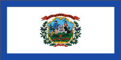
| Colors | Blue And Gold (Official) (1863) |
| Songs | “West Virginia, My Home Sweet Home,” “The West Virginia Hills,” And “This Is My West Virginia” (Adopted By Legislature In 1947, 1961, And 1963 As Official State Songs) |
Demographics
- Population Density
- 75.1 people per square mile
Geography and Weather
- Land Area
- 24,077 sq mi. (62,359 sq km)
- Lowest Elevation
- 0 ft (0 m)
- Average Elevation
- 1500 ft (457.2 m)
- Highest Temperature Recorded
- 112°F (44°C) on July 10, 1936
- Lowest Temperature Recorded
- –37°F (–38°C) on December 30, 1917

